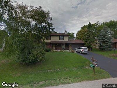
S77W17605 St Leonards Dr Muskego, WI 53150
Estimated Value: $420,567 - $552,000
4
Beds
2
Baths
1,840
Sq Ft
$251/Sq Ft
Est. Value
About This Home
This home is located at S77W17605 St Leonards Dr, Muskego, WI 53150 and is currently estimated at $462,392, approximately $251 per square foot. S77W17605 St Leonards Dr is a home located in Waukesha County with nearby schools including Muskego Lakes Middle School, Muskego High School, and St. Leonard School.
Ownership History
Date
Name
Owned For
Owner Type
Purchase Details
Closed on
Apr 3, 2020
Sold by
Mura Joann P
Bought by
Knudsen Mark and Giersch Megan
Current Estimated Value
Home Financials for this Owner
Home Financials are based on the most recent Mortgage that was taken out on this home.
Original Mortgage
$265,600
Interest Rate
3.2%
Mortgage Type
FHA
Create a Home Valuation Report for This Property
The Home Valuation Report is an in-depth analysis detailing your home's value as well as a comparison with similar homes in the area
Home Values in the Area
Average Home Value in this Area
Purchase History
| Date | Buyer | Sale Price | Title Company |
|---|---|---|---|
| Knudsen Mark | $270,500 | None Available |
Source: Public Records
Mortgage History
| Date | Status | Borrower | Loan Amount |
|---|---|---|---|
| Open | Knudsen Mark | $55,000 | |
| Open | Knudsen Mark A | $500,000 | |
| Closed | Knudsen Mark | $0 | |
| Closed | Knudsen Mark | $19,321 | |
| Previous Owner | Knudsen Mark | $265,600 |
Source: Public Records
Tax History Compared to Growth
Tax History
| Year | Tax Paid | Tax Assessment Tax Assessment Total Assessment is a certain percentage of the fair market value that is determined by local assessors to be the total taxable value of land and additions on the property. | Land | Improvement |
|---|---|---|---|---|
| 2024 | $3,533 | $297,600 | $69,300 | $228,300 |
| 2023 | $3,515 | $297,600 | $69,300 | $228,300 |
| 2022 | $3,416 | $297,600 | $69,300 | $228,300 |
| 2021 | $3,399 | $297,600 | $69,300 | $228,300 |
| 2020 | $3,478 | $252,300 | $60,400 | $191,900 |
| 2019 | $3,447 | $252,300 | $60,400 | $191,900 |
| 2018 | $3,643 | $252,300 | $60,400 | $191,900 |
| 2017 | $4,118 | $252,300 | $60,400 | $191,900 |
| 2016 | $3,540 | $227,900 | $57,400 | $170,500 |
| 2015 | $3,577 | $227,900 | $57,400 | $170,500 |
| 2014 | $3,894 | $227,900 | $57,400 | $170,500 |
| 2013 | $3,894 | $227,900 | $57,400 | $170,500 |
Source: Public Records
Map
Nearby Homes
- W176S7774 Kristin Dr
- S76W17745 Janesville Rd
- S75W17553 Harbor Cir Unit 1B
- W173S7826 Westwood Dr
- W177S7495 Harbor Cir Unit 6D
- S80W17710 Brennan Dr
- Lt4 Lannon Dr
- S77W18401 Kelly Dr
- W171S7452 Lannon Dr
- S98W13808 Jay Dr
- S77W18512 Janesville Rd
- W188S7598 Oak Grove Dr
- S70W16883 Hedgewood Dr
- S78W16075 Woods Rd
- S78W15870 Kayla Ln
- W191S7367 Shore Ln
- W193S7842 Overlook Bay Rd Unit 7F
- S70W18778 Gold Dr
- W193S7927 Ancient Oaks Dr
- W194S7764 Overlook Bay Rd Unit A