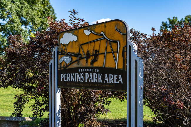
Residential living around a park in Perkins Park Area
On the edges of Green Bay’s northwestern side, Perkins Park Area is a small collection of residential streets surrounding a community park—Perkins Park. This side of Green Bay is saturated with green space, with neighborhood parks just a few blocks down the street and a paved walking path cutting through the community. With so many parks and recreational space surrounding this community, residents take on an active lifestyle. “You’ll see people out walking or riding bikes and out in their yards,” says Realtor Jerrilynn Vandenberg with Fireside Realty. “And walking to the park, of course.” Even with plenty of parks to choose from, residents won’t feel like they are living in the wilderness—Military Avenue is lined with restaurants, shops and grocery stores for increased accessibility.
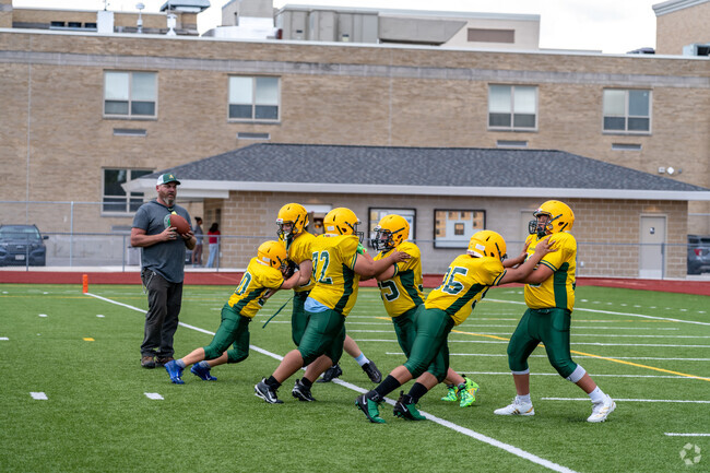
Teams from all over Green Bay play against each other at Perkins Park's various fields.
Hit the Benjamin Edinger trail that runs through Perkins Park for a healthy dose of fresh air.
1/2
Disc golf at Perkins Park and wading in the pool at Mather Heights Park
All around the houses, Perkins Park offers 59 acres of recreational green space, including a disc golf course that stretches across the park. People can come here to play basketball, tennis and volleyball at the various courts, and there’s a playground for the kids. In the winter, people can skate at the hockey rink or cross-country ski over the grounds. Just across Platten Street is Mather Heights Park, which features a wading pool kids can use to cool off in the summer. There’s also soccer and baseball fields. Sargeant Benjamin Edinger Corridor West Side is a paved path that stretches from Dousman Street to Shawano Avenue, where people can walk, jog or bike along the tree-shaded path.
Meet with friends at Perkins Park for a game of tennis on its expansive courts.
The splash pad at Mather Heights Park is a favorite destination for kids during the summer.
1/2
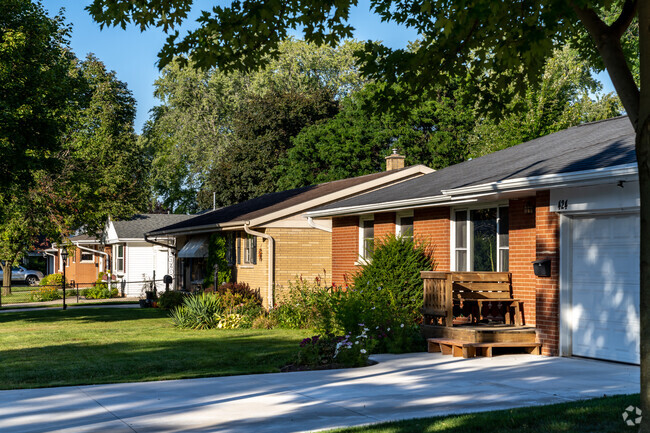
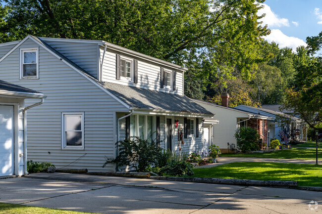
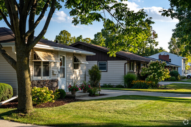
Perkins Park Area's ranches and Colonial Revivals
Along Perkins Park Area’s tree-lined streets are a mix of ranches and Colonial Revivals. In the fall, the leaves turn brilliant oranges and yellows, creating a scenic walk to the park or just along the residential streets. There are also alternative housing options in this community, with several apartment complexes and condos available along Moraine Way on the northwestern side of Perkins Park Area. Altogether, the homes, condos and duplexes typically sell for between $200,000 and $300,000.
Ranch style homes in Perkins Park Area are ideal for first time home buyers.
Colonial style homes in Perkins Park Area offer plenty of room for growing families.
West High School has 862 students.
1/3
Perkins Park Area's International Baccalaureate options
Students living in Perkins Park Area can participate in International Baccalaureate (IB) programs at every level of their education. With a C-plus from Niche, Chappell Elementary School offers the IB Primary Years Program, where students can learn Spanish. Franklin Middle School offers the IB Middle Years Programme and earns a C from Niche. West High receives a B-minus from Niche and offers the IB Diploma Programme alongside Advanced Placement (AP) and concurrent enrollment program (CEP) courses.
Chappell Elementary School is a K-5th grade school on the west-side of Green Bay.
Franklin Middle School Scores a C- in academics by Niche.
1/2
Driving to downtown or Broadway from Perkins Park Area
Perkins Park Area’s southern border is Shawano Avenue, which people can take to get to downtown Green Bay on the other side of the Fox River, about 3.5 miles away. Buses line Shawano Avenue and Dousman Street, for an alternative way to get downtown or to the Broadway District for more shopping and dining options. HSHS Saint Mary’s Hospital Medical Center is 1 miles away, along Shawano Avenue. I-43 and I-41, respectively, are to the north and west of the community, connecting people to Green Bay Austin Straubel International Airport, 8.5 miles away.
Metro Transit stops are stationed throughout Perkins Park Area, making access to downtown easy.
Find all your home needs at shops located along Military Avenue.
1/2
Perkins Park Area's local restaurants along Military Avenue
Military Avenue runs along the western side of Perkins Park Area, lined with local restaurants and grocery stores. “There’s mom-and-pop restaurants, but also big box stores,” Vandenberg says. “Stores like Petco, TJ Maxx, Starbucks—you name it, you got it within a mile.” The Pancake Place has been a Green Bay staple for over 40 years. While it serves breakfast and lunch classics, they are known for their large pancakes that cover an entire plate. Also along Military Avenue is Bhava Coffee, a locally-owned coffeeshop that sweetens its drinks with unique flavors like birthday cake and orange creamsicle. Perkins Park Area is also just a couple of miles from Green Bay’s Broadway District, which offers more restaurants, like Titletown Brewing Company, a brewery with a rooftop cocktail bar and plenty of Packers memorabilia. For groceries, Aldi is just under a mile away along Military Avenue. Down Shawano Avenue, Meijer is 1.5 miles away.
Meet with friends at the famous Pancake Place for breakfast before tailgating.
Grab a coffee on the go using the drive up window at Bhava Coffee.
1/2
Green Bay's football games and farmers' markets
Because Perkins Park Area is mainly residential and recreational space, there aren’t many events over on this side of town. Instead, residents can head over to the Broadway District during the summer for the Farmers’ Market on Broadway. Every Wednesday afternoon, this market features over 100 local vendors and live music, and locals love to come here to socialize while shopping. During the fall, many residents head down to Lambeau Field to watch the Packers play. The stadium and its adjacent Titletown commercial restaurant and shopping district is about 3 miles south of Perkins Park Area.
Visit the nearby Farmers Market on Broadway for fresh produce, barbecue, and live music.
Restaurants in and around Perkins Park Area feature live music throughout the summer months.
1/2
Noise levels around Perkins Park Area
Because of the interstates so close by and the train tracks to the north of Perkins Park Area, residents along the northern side might expect increased noise levels when traffic is higher.
Perkins Park Area is located just minutes from the I-43 interchange, making commutes easy.
Freight trains regularly run through and around Perkins Park Area.
GreatSchools:
The GreatSchools Rating helps parents compare schools within a state based on a variety of school quality indicators and provides a helpful picture of how effectively each school serves all of its students. Ratings are on a scale of 1 (below average) to 10 (above average) and can include test scores, college readiness, academic progress, advanced courses, equity, discipline and attendance data. We also advise parents to visit schools, consider other information on school performance and programs, and consider family needs as part of the school selection process.
View GreatSchools Rating Methodology
Interested in learning more about homes in this area?
Reach out to
Abbi Lonick,
an experienced agent in this neighborhood.
Parks in this Area
Chappell Park
Perkins Park
Mather Heights Park
Barkhausen Waterfowl Preserve
Brown County Reforestation Camp
NEW Zoo & Adventure Park
Badger Park
Duck Creek Quarry Beach
Transit
Airport
Green Bay/Austin Straubel International
15 min drive
Bus
Shawano & Locust Outbound
Bus
Dousman & Fisk Outbound
Bus
Shawano & Military Outbound
Bus
Military & Bond Outbound
Bus
Velp & Locust Inbound
Bus
Military & Dousman
Bus
Dousman & Military Outbound
Crime and Safety
1 - Low Crime, 10 - High Crime
Perkins Park Area
US
Homicide
4
4
Sexual Assault
6
4
Assault with Weapon
5
4
Robbery
4
4
Burglary
5
4
Motor Vehicle Theft
5
4
Larceny
5
4
Crime Score
5
4
Source: WhatIsMyCrimeRisk.com
Demographics and Home Trends
On average, homes in Perkins Park Area, Green Bay sell after 44 days on the market compared to the national average of 47 days. The average sale price for homes in Perkins Park Area, Green Bay over the last 12 months is $249,726, up 4% from the average home sale price over the previous 12 months.
Located in a quiet neighborhood on Green Bay's northwest side. This property is surrounded by picturesque park property, that is near schools, nature area, on the bus line, and is just moments from Interstates 41 and 43, so all your needs are within reach.Apartments feature spacious bedrooms and living rooms. Each apartment also includes heat, an air conditioner, a detached garage and
Welcome to the beautiful Perkins Heights Apartments in Green Bay, WI. Our apartments offer a peaceful, friendly, and village living experience. Green Bay offers an abundance of entertainment for its residents including parks, shopping, high quality restaurants, and an exciting night life. Located just minutes from highways 41 and 43 traveling is made easy, and residents have access to groceries
Interested in learning more about homes in this area?
Reach out to
Abbi Lonick,
an experienced agent in this neighborhood.
Average Home Value
Source: Public Records
Property Mix - Square Feet
This Neighborhood Has More Renters
Demographics
Total Population
1,886
Median Age
36
Population Density
5 ppl/acre
Population under 18
25.6%
On par with the national average
23.8%
Population over 65
17.3%
On par with the national average
19.1%
Finances
Median Household Income
$44,053
Significantly below the national average
$71,702
Average Household Income
$57,044
Education and Workforce
High School Graduates
89.1%
College Graduates
9.9%
Below the national average
34.1%
Advanced Degrees
1.6%
Below the national average
13.3%
% Population in Labor Force
73.6%
Weather
Annual Precipitation
32''
Average Winter Low Temperature
11°F
Average Summer High Temperature
81°F
Annual Snowfall
68''
Area Factors
Bikeable
Bike Score®
62/ 100
Car-Dependent
Walk Score®
36/ 100
Minimal Transit
Transit Score®
24/ 100
Source: Walk Score
Source: Walk Score
Sound Score® measures the noise level of any address. Transit Score® measures access to public transit. Bike Score® measures the bikeability of any address.
Disclaimer: Certain information contained herein is derived from information provided by parties other than Homes.com. Our sources include: Accuweather, Public Records and Neustar. All information provided is deemed reliable, but is not guaranteed to be accurate and should be independently verified.