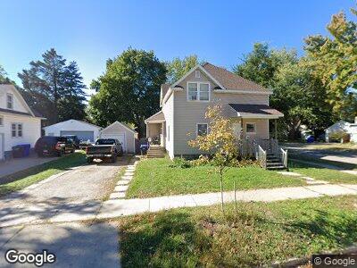
1019 N Division St Appleton, WI 54911
Historic Central Neighborhood NeighborhoodEstimated Value: $172,000 - $214,000
1
Bed
1
Bath
--
Sq Ft
7,187
Sq Ft Lot
About This Home
This home is located at 1019 N Division St, Appleton, WI 54911 and is currently estimated at $186,272. 1019 N Division St is a home located in Outagamie County with nearby schools including Columbus Elementary School, Appleton North High School, and Appleton Bilingual School.
Ownership History
Date
Name
Owned For
Owner Type
Purchase Details
Closed on
Feb 24, 2022
Sold by
Tobie John W and Tobie Denes L
Bought by
1019 N Division Llc
Current Estimated Value
Home Financials for this Owner
Home Financials are based on the most recent Mortgage that was taken out on this home.
Original Mortgage
$103,850
Interest Rate
3.69%
Mortgage Type
New Conventional
Purchase Details
Closed on
Oct 19, 2006
Sold by
Lang Mark K
Bought by
Tobie John W and Tobie Denes L
Create a Home Valuation Report for This Property
The Home Valuation Report is an in-depth analysis detailing your home's value as well as a comparison with similar homes in the area
Home Values in the Area
Average Home Value in this Area
Purchase History
| Date | Buyer | Sale Price | Title Company |
|---|---|---|---|
| 1019 N Division Llc | $87,500 | New Title Company Name | |
| 1019 N Division Llc | $87,500 | New Title Company Name | |
| Tobie John W | $67,000 | Stewart Title |
Source: Public Records
Mortgage History
| Date | Status | Borrower | Loan Amount |
|---|---|---|---|
| Open | 1019 N Division Llc | $200,000 | |
| Closed | 1019 N Division Llc | $103,850 |
Source: Public Records
Tax History Compared to Growth
Tax History
| Year | Tax Paid | Tax Assessment Tax Assessment Total Assessment is a certain percentage of the fair market value that is determined by local assessors to be the total taxable value of land and additions on the property. | Land | Improvement |
|---|---|---|---|---|
| 2024 | $1,999 | $133,600 | $26,500 | $107,100 |
| 2023 | $2,112 | $133,600 | $26,500 | $107,100 |
| 2022 | $2,138 | $100,500 | $21,700 | $78,800 |
| 2021 | $2,047 | $100,500 | $21,700 | $78,800 |
| 2020 | $2,006 | $100,500 | $21,700 | $78,800 |
| 2019 | $1,960 | $100,500 | $21,700 | $78,800 |
| 2018 | $2,778 | $83,000 | $17,900 | $65,100 |
| 2017 | $2,521 | $83,000 | $17,900 | $65,100 |
| 2016 | $1,779 | $83,000 | $17,900 | $65,100 |
| 2015 | $1,799 | $83,000 | $17,900 | $65,100 |
| 2014 | $1,786 | $83,000 | $17,900 | $65,100 |
| 2013 | $2,011 | $92,900 | $17,900 | $75,000 |
Source: Public Records
Map
Nearby Homes
- 808 N Oneida St
- 602 N State St
- 614 N Appleton St
- 406 W Brewster St
- 503 N Garfield Place
- 108 E Atlantic St
- 734 W Elsie St
- 1502 N Richmond St
- 1525 N Erb St
- 830 N Bennett St
- 308 E Pacific St
- 723 W Grant St
- 1009 W Winnebago St
- 124 N Green Bay Rd
- 1724 S Hycrest Dr
- 211 W College Ave
- 1024 W Bell Ave
- 2002 N Clark St
- 1206 W Elsie St
- 1109 W Harris St