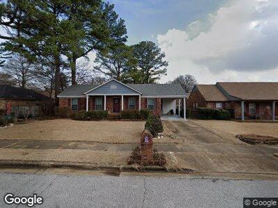
1598 Pinecrest Dr Memphis, TN 38111
Orange Mound NeighborhoodEstimated Value: $119,000 - $164,000
3
Beds
2
Baths
1,506
Sq Ft
$93/Sq Ft
Est. Value
About This Home
This home is located at 1598 Pinecrest Dr, Memphis, TN 38111 and is currently estimated at $139,421, approximately $92 per square foot. 1598 Pinecrest Dr is a home located in Shelby County with nearby schools including Cherokee Elementary School, Sherwood Middle, and Melrose High School.
Ownership History
Date
Name
Owned For
Owner Type
Purchase Details
Closed on
Mar 16, 2004
Sold by
Hollingshed Wayne T and Hollingshed Elaine
Bought by
Simmons Vicky
Current Estimated Value
Home Financials for this Owner
Home Financials are based on the most recent Mortgage that was taken out on this home.
Original Mortgage
$90,000
Interest Rate
8.25%
Mortgage Type
Purchase Money Mortgage
Create a Home Valuation Report for This Property
The Home Valuation Report is an in-depth analysis detailing your home's value as well as a comparison with similar homes in the area
Home Values in the Area
Average Home Value in this Area
Purchase History
| Date | Buyer | Sale Price | Title Company |
|---|---|---|---|
| Simmons Vicky | $90,000 | Southern Trust Title Company |
Source: Public Records
Mortgage History
| Date | Status | Borrower | Loan Amount |
|---|---|---|---|
| Open | Simmons Vicky | $1,605 | |
| Open | Simmons Vicky | $100,512 | |
| Closed | Simmons Vicky | $95,846 | |
| Closed | Simmons Vicky L | $93,430 | |
| Closed | Simmons Vicky | $90,000 | |
| Previous Owner | Hollingshed Wayne T | $148,158 |
Source: Public Records
Tax History Compared to Growth
Tax History
| Year | Tax Paid | Tax Assessment Tax Assessment Total Assessment is a certain percentage of the fair market value that is determined by local assessors to be the total taxable value of land and additions on the property. | Land | Improvement |
|---|---|---|---|---|
| 2024 | $799 | $23,575 | $2,375 | $21,200 |
| 2023 | $1,436 | $23,575 | $2,375 | $21,200 |
| 2022 | $1,436 | $23,575 | $2,375 | $21,200 |
| 2021 | $1,453 | $23,575 | $2,375 | $21,200 |
| 2020 | $1,556 | $21,475 | $2,375 | $19,100 |
| 2019 | $1,556 | $21,475 | $2,375 | $19,100 |
| 2018 | $1,556 | $21,475 | $2,375 | $19,100 |
| 2017 | $883 | $21,475 | $2,375 | $19,100 |
| 2016 | $836 | $19,125 | $0 | $0 |
| 2014 | $836 | $19,125 | $0 | $0 |
Source: Public Records
Map
Nearby Homes
- 1625 Westlawn Dr
- 1581 Eastlawn St
- 3130 Harris Ave
- 3129 Beaumont Ave
- 1601 Semmes St
- 1771 Wildrose St
- 1773 Wildrose St
- 1417 Semmes St Unit 26
- 2986 Lounette St
- 1454 Railton Rd
- 2940 N Harris Cir
- 1515 Hope St
- 2922 Semmes St
- 3017 Gulf Ave Unit 7
- 2939 Armistead Ave
- 3417 Hendricks Ave
- 3092 Kimball Ave
- 2879 Semmes St
- 0 Southwall St
- 1303 Inman Rd