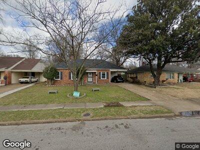
3810 Philsdale Ave Memphis, TN 38111
Audubon Park NeighborhoodEstimated Value: $75,000 - $112,943
3
Beds
2
Baths
1,196
Sq Ft
$83/Sq Ft
Est. Value
About This Home
This home is located at 3810 Philsdale Ave, Memphis, TN 38111 and is currently estimated at $98,986, approximately $82 per square foot. 3810 Philsdale Ave is a home located in Shelby County with nearby schools including Sherwood Elementary School, Sherwood Middle, and Melrose High School.
Ownership History
Date
Name
Owned For
Owner Type
Purchase Details
Closed on
Oct 11, 2022
Sold by
Douglas Alan R
Bought by
Alan R Douglas And Christine Laura Douglas 20
Current Estimated Value
Purchase Details
Closed on
Jun 21, 2010
Sold by
Wells Fargo Bank Na
Bought by
Douglas Alan R and Laura Douglas C
Purchase Details
Closed on
Dec 8, 2009
Sold by
Hunt Bobby R
Bought by
Wells Fargo Bank Na
Purchase Details
Closed on
Jul 17, 2006
Sold by
Brown Bobby
Bought by
Ground Breaking Enterprises Llc
Purchase Details
Closed on
Jul 25, 1995
Bought by
Hunt Gregory L and Hunt Bobby R
Create a Home Valuation Report for This Property
The Home Valuation Report is an in-depth analysis detailing your home's value as well as a comparison with similar homes in the area
Home Values in the Area
Average Home Value in this Area
Purchase History
| Date | Buyer | Sale Price | Title Company |
|---|---|---|---|
| Alan R Douglas And Christine Laura Douglas 20 | -- | -- | |
| Douglas Alan R | $33,000 | None Available | |
| Wells Fargo Bank Na | $56,746 | None Available | |
| Ground Breaking Enterprises Llc | $67,589 | None Available | |
| Brown Bobby R | -- | None Available | |
| Hunt Gregory L | $53,999 | -- |
Source: Public Records
Mortgage History
| Date | Status | Borrower | Loan Amount |
|---|---|---|---|
| Previous Owner | Hunt Bobby R | $68,400 |
Source: Public Records
Tax History Compared to Growth
Tax History
| Year | Tax Paid | Tax Assessment Tax Assessment Total Assessment is a certain percentage of the fair market value that is determined by local assessors to be the total taxable value of land and additions on the property. | Land | Improvement |
|---|---|---|---|---|
| 2024 | $560 | $16,525 | $2,975 | $13,550 |
| 2023 | $1,007 | $16,525 | $2,975 | $13,550 |
| 2022 | $1,007 | $16,525 | $2,975 | $13,550 |
| 2021 | $570 | $16,525 | $2,975 | $13,550 |
| 2020 | $989 | $13,650 | $2,975 | $10,675 |
| 2019 | $436 | $13,650 | $2,975 | $10,675 |
| 2018 | $436 | $13,650 | $2,975 | $10,675 |
| 2017 | $447 | $13,650 | $2,975 | $10,675 |
| 2016 | $565 | $12,925 | $0 | $0 |
| 2014 | $565 | $12,925 | $0 | $0 |
Source: Public Records
Map
Nearby Homes
- 3731 Deerwood Cove
- 3845 Kimball Ave
- 3735 Kimball Ave
- 3787 Rhodes Ave
- 3812 Rhodes Ave
- 3850 Rhodes Ave
- 3784 Dunn Ave
- 1293 Dogwood Dr
- 3969 Southlawn Ave
- 1164 Goodman St
- 1303 Dogwood Dr
- 1296 Elkwood St
- 1253 Dogwood Dr
- 3551 Fawn Cove
- 4081 Fizer Ave
- 1558 Patterson St
- 1422 Titus Rd
- 3788 Healey Rd
- 3507 Kimball Ave
- 1129 Catalina St