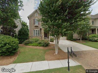
463 Lancashire Dr Marietta, GA 30068
Estimated Value: $1,183,250 - $1,412,000
4
Beds
4
Baths
3,521
Sq Ft
$374/Sq Ft
Est. Value
About This Home
This home is located at 463 Lancashire Dr, Marietta, GA 30068 and is currently estimated at $1,318,083, approximately $374 per square foot. 463 Lancashire Dr is a home with nearby schools including Mount Bethel Elementary School, Dickerson Middle School, and Walton High School.
Ownership History
Date
Name
Owned For
Owner Type
Purchase Details
Closed on
Mar 23, 2016
Sold by
Ashton Atlanta Residential Llc
Bought by
Brooks Robert A
Current Estimated Value
Home Financials for this Owner
Home Financials are based on the most recent Mortgage that was taken out on this home.
Original Mortgage
$450,000
Interest Rate
3.62%
Mortgage Type
New Conventional
Purchase Details
Closed on
Oct 30, 2015
Sold by
Gdci Ga 4 Lp
Bought by
Ashton Atlanta Residential Llc
Create a Home Valuation Report for This Property
The Home Valuation Report is an in-depth analysis detailing your home's value as well as a comparison with similar homes in the area
Home Values in the Area
Average Home Value in this Area
Purchase History
| Date | Buyer | Sale Price | Title Company |
|---|---|---|---|
| Brooks Robert A | $806,244 | -- | |
| Brooks Robert A | -- | -- | |
| Ashton Atlanta Residential Llc | $1,923,750 | -- |
Source: Public Records
Mortgage History
| Date | Status | Borrower | Loan Amount |
|---|---|---|---|
| Open | Brooks Robert A | $375,156 | |
| Closed | Brooks Robert A | $450,000 |
Source: Public Records
Tax History Compared to Growth
Tax History
| Year | Tax Paid | Tax Assessment Tax Assessment Total Assessment is a certain percentage of the fair market value that is determined by local assessors to be the total taxable value of land and additions on the property. | Land | Improvement |
|---|---|---|---|---|
| 2024 | $10,963 | $394,400 | $112,000 | $282,400 |
| 2023 | $11,160 | $428,532 | $112,000 | $316,532 |
| 2022 | $9,527 | $325,288 | $92,000 | $233,288 |
| 2021 | $9,527 | $325,288 | $92,000 | $233,288 |
| 2020 | $9,340 | $316,748 | $92,000 | $224,748 |
| 2019 | $9,340 | $316,748 | $92,000 | $224,748 |
| 2018 | $9,340 | $316,748 | $92,000 | $224,748 |
| 2017 | $8,850 | $316,748 | $92,000 | $224,748 |
| 2016 | $4,844 | $168,488 | $80,000 | $88,488 |
| 2015 | $1,768 | $60,000 | $60,000 | $0 |
Source: Public Records
Map
Nearby Homes
- 4892 Kentwood Dr
- 4958 Meadow Ln Unit 4958
- 4916 Kentwood Dr
- 4850 Kentwood Dr
- 4974 Meadow Ln
- 4992 Meadow Ln
- 4988 Meadow Ln
- 5058 Meadow Ln
- 105 Park Ridge Cir
- 4964 N Ellipse
- 320 Park Ridge Cir Unit 320
- 4508 Oakside Point
- 601 Park Ridge Cir
- 341 Declaire Way NE
- 1401 Parkaire Crossing Unit 1401
- 1403 Parkaire Crossing Unit 1403
- 4605 Woodlawn Gates Ln