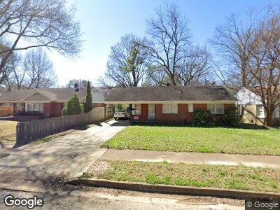
5049 Kaye Rd Memphis, TN 38117
Colonial Acres NeighborhoodEstimated Value: $175,000 - $186,000
3
Beds
1
Bath
945
Sq Ft
$192/Sq Ft
Est. Value
About This Home
This home is located at 5049 Kaye Rd, Memphis, TN 38117 and is currently estimated at $181,116, approximately $191 per square foot. 5049 Kaye Rd is a home located in Shelby County with nearby schools including Sea Isle Elementary School, Colonial Middle, and Overton High.
Ownership History
Date
Name
Owned For
Owner Type
Purchase Details
Closed on
Aug 24, 2001
Sold by
Lambert Altha R and Lambert Carl B
Bought by
Mccall James R and Mccall Janette R
Current Estimated Value
Home Financials for this Owner
Home Financials are based on the most recent Mortgage that was taken out on this home.
Original Mortgage
$68,500
Interest Rate
9%
Mortgage Type
Purchase Money Mortgage
Purchase Details
Closed on
Jun 30, 2000
Sold by
Lambert Carl B
Bought by
Lambert Altha R and Lambert Carl B
Create a Home Valuation Report for This Property
The Home Valuation Report is an in-depth analysis detailing your home's value as well as a comparison with similar homes in the area
Home Values in the Area
Average Home Value in this Area
Purchase History
| Date | Buyer | Sale Price | Title Company |
|---|---|---|---|
| -- | $70,000 | Mid South Title | |
| Lambert Altha R | -- | Stewart Title Company |
Source: Public Records
Mortgage History
| Date | Status | Borrower | Loan Amount |
|---|---|---|---|
| Open | Mccall Janette Ruth | $310,861 | |
| Closed | Mccall James R | $73,069 | |
| Closed | Mccall James R | $73,000 | |
| Closed | -- | $68,500 | |
| Previous Owner | Lambert Carl B | $48,500 |
Source: Public Records
Tax History Compared to Growth
Tax History
| Year | Tax Paid | Tax Assessment Tax Assessment Total Assessment is a certain percentage of the fair market value that is determined by local assessors to be the total taxable value of land and additions on the property. | Land | Improvement |
|---|---|---|---|---|
| 2024 | $1,090 | $32,150 | $7,050 | $25,100 |
| 2023 | $1,958 | $32,150 | $7,050 | $25,100 |
| 2022 | $1,958 | $32,150 | $7,050 | $25,100 |
| 2021 | $1,981 | $32,150 | $7,050 | $25,100 |
| 2020 | $1,754 | $24,200 | $7,050 | $17,150 |
| 2019 | $1,754 | $24,200 | $7,050 | $17,150 |
| 2018 | $1,754 | $24,200 | $7,050 | $17,150 |
| 2017 | $995 | $24,200 | $7,050 | $17,150 |
| 2016 | $977 | $22,350 | $0 | $0 |
| 2014 | $977 | $22,350 | $0 | $0 |
Source: Public Records
Map
Nearby Homes
- 5019 Kaye Rd
- 5067 Welchshire Ave
- 5094 Alrose Ave
- 4949 Hampshire Ave
- 4921 Alrose Ave
- 5030 Dee Rd
- 4942 Essexshire Ave
- 5051 Dee Rd
- 4898 Hampshire Ave
- 5188 Edenshire Ave
- 1072 Ivy Rd
- 4947 Dee Rd
- 1175 Mount Moriah Rd
- 1144 Wellsville Rd
- 1089 Ivy Rd
- 1201 S White Station Rd
- 4888 Dee Rd
- 1191 Wilmore Rd
- 1231 S White Station Rd
- 5270 Edenshire Ave