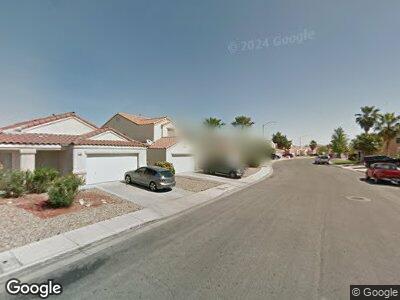
712 Red Bark Ln Henderson, NV 89011
South Valley Ranch NeighborhoodEstimated Value: $426,796 - $458,000
4
Beds
2
Baths
2,182
Sq Ft
$201/Sq Ft
Est. Value
About This Home
This home is located at 712 Red Bark Ln, Henderson, NV 89011 and is currently estimated at $437,949, approximately $200 per square foot. 712 Red Bark Ln is a home located in Clark County with nearby schools including Josh Stevens Elementary School, Francis H Cortney Junior High School, and Basic Academy of International Studies.
Ownership History
Date
Name
Owned For
Owner Type
Purchase Details
Closed on
Oct 20, 2017
Sold by
Ball Daniel C and Tapper Danielle C
Bought by
Tapper Michael J and Tapper Danielle C
Current Estimated Value
Home Financials for this Owner
Home Financials are based on the most recent Mortgage that was taken out on this home.
Original Mortgage
$135,000
Interest Rate
3.93%
Mortgage Type
New Conventional
Purchase Details
Closed on
Feb 10, 2003
Sold by
Ball Matthew B
Bought by
Ball Danielle C
Purchase Details
Closed on
Jul 27, 2000
Sold by
Kaufman & Broad Of Nevada Inc
Bought by
Ball Matthew B and Ball Danielle C
Home Financials for this Owner
Home Financials are based on the most recent Mortgage that was taken out on this home.
Original Mortgage
$109,831
Interest Rate
8.12%
Mortgage Type
FHA
Create a Home Valuation Report for This Property
The Home Valuation Report is an in-depth analysis detailing your home's value as well as a comparison with similar homes in the area
Home Values in the Area
Average Home Value in this Area
Purchase History
| Date | Buyer | Sale Price | Title Company |
|---|---|---|---|
| Tapper Michael J | -- | None Available | |
| Ball Danielle C | $14,854 | -- | |
| Ball Matthew B | $110,000 | First American Title Co |
Source: Public Records
Mortgage History
| Date | Status | Borrower | Loan Amount |
|---|---|---|---|
| Closed | Tapper Michael J | $284,000 | |
| Closed | Tapper Michael J | $213,600 | |
| Closed | Tapper Michael J | $135,000 | |
| Closed | Ball Danielle C | $109,191 | |
| Previous Owner | Ball Matthew B | $109,831 |
Source: Public Records
Tax History Compared to Growth
Tax History
| Year | Tax Paid | Tax Assessment Tax Assessment Total Assessment is a certain percentage of the fair market value that is determined by local assessors to be the total taxable value of land and additions on the property. | Land | Improvement |
|---|---|---|---|---|
| 2025 | $1,537 | $99,976 | $31,150 | $68,826 |
| 2024 | $1,493 | $99,976 | $31,150 | $68,826 |
| 2023 | $1,493 | $94,931 | $29,400 | $65,531 |
| 2022 | $1,449 | $84,762 | $24,850 | $59,912 |
| 2021 | $1,407 | $78,753 | $21,700 | $57,053 |
| 2020 | $1,363 | $78,465 | $21,700 | $56,765 |
| 2019 | $1,347 | $74,879 | $18,900 | $55,979 |
| 2018 | $1,285 | $68,998 | $15,400 | $53,598 |
| 2017 | $1,940 | $66,931 | $12,600 | $54,331 |
| 2016 | $1,204 | $62,096 | $9,800 | $52,296 |
| 2015 | $1,201 | $48,399 | $8,050 | $40,349 |
| 2014 | $1,165 | $39,034 | $6,125 | $32,909 |
Source: Public Records
Map
Nearby Homes
- 1013 Adobe Flat Dr
- 700 Pine Field Ln
- 612 Bullwhip Ct Unit AIV
- 689 Hitchen Post Dr
- 733 Hitchen Post Dr
- 672 Hitchen Post Dr
- 1069 Silver Bullet Ct
- 1073 Silver Bullet Ct
- 632 Hitchen Post Dr
- 1069 Wide Brim Ct
- 1077 Colt Arms St
- 884 Adobe Flat Dr
- 833 Aspen Peak Loop Unit 2511
- 833 Aspen Peak Loop Unit 1026
- 833 Aspen Peak Loop Unit 1021
- 833 Aspen Peak Loop Unit 2613
- 833 Aspen Peak Loop Unit 2614
- 833 Aspen Peak Loop Unit 2522
- 833 Aspen Peak Loop Unit 712
- 833 Aspen Peak Loop Unit 1524